

| Total route length (approximate) | 650 miles (Caltrans / California Coastal Commission estimates) |
| Southern terminus | Dana Point, Orange County |
| Northern terminus (SR-1) | Leggett, Mendocino County |
| Recommended travel direction | South to north (ocean on driver's left) |
| Most scenic segment | Big Sur (~90 miles, San Simeon to Carmel) (Widely cited by travel writers and park rangers) |
| Landslide / closure risk | High — verify via Caltrans before departure (Caltrans QuickMap (quickmap.dot.ca.gov)) |
| Minimum drive time (full route) | 2 days (not recommended) |
| Comfortable drive time | 7–10 days |
The Route at a Glance
The Pacific Coast Highway — officially California State Route 1, though locals often use "PCH" to mean the broader coastal corridor combining SR-1 and US-101 — stretches roughly 650 miles between Dana Point in Southern California and Leggett in the north. Most road trippers drive it from south to north to keep the ocean on their side of the car, maximizing views of cliffs, coves, and beaches without craning across traffic.
| Total route length (approximate) | 650 miles (Caltrans / California Coastal Commission estimates) |
| Southern terminus | Dana Point, Orange County |
| Northern terminus (SR-1) | Leggett, Mendocino County |
| Recommended travel direction | South to north (ocean on driver's left) |
| Most scenic segment | Big Sur (~90 miles, San Simeon to Carmel) (Widely cited by travel writers and park rangers) |
| Landslide / closure risk | High — verify via Caltrans before departure (Caltrans QuickMap (quickmap.dot.ca.gov)) |
| Minimum drive time (full route) | 2 days (not recommended) |
| Comfortable drive time | 7–10 days |
The full drive takes anywhere from two days (rushed) to ten or more (leisurely). The majority of scenic highlights cluster in three distinct stretches: the Southern California coast, the Central Coast, and the Big Sur corridor. Each has its own character, road conditions, and things that catch drivers off guard — so knowing what you're rolling into helps enormously.
For a broader look at American drives that feel deceptively simple on a map, see our guide to roads that surprise first-timers.
Southern California: Dana Point to Malibu
The drive begins in the subdued beach-town atmosphere of Dana Point and winds north through Laguna Beach, Newport Beach, and eventually Santa Monica. This section is heavily trafficked — particularly through Los Angeles — and the scenery alternates between wide sandy beaches, coastal neighborhoods, and busy commercial strips. Don't expect solitude here.
Malibu is where the character begins to shift. The Santa Monica Mountains push toward the water, the road narrows, and surfers share the roadside with hikers. Point Mugu State Park signals the true start of the wilder coast. Traffic thins noticeably past Oxnard.
Central Coast: Ventura to San Luis Obispo
North of Ventura, the drive opens up into agricultural lowlands before the coast reasserts itself around Santa Barbara. This stretch is arguably the most underrated segment of the route — rolling vineyards, eucalyptus groves, and the red-roofed Spanish-Colonial architecture of Santa Barbara create a distinct visual rhythm.
Pismo Beach and San Luis Obispo anchor the northern end of this segment. Pismo's broad sand dunes are a genuine landmark; the Oceano Dunes Natural Preserve edges the highway here. Morro Rock — a volcanic plug rising dramatically from the harbor at Morro Bay — is one of PCH's most recognizable geological landmarks and worth a stop.
Hearst Castle: Plan Ahead for Access
Hearst Castle State Historical Monument sits just off PCH near San Simeon and requires advance reservations for tours — walk-up access is generally not available. The site is managed by California State Parks, and tour availability varies by season. Check the official California State Parks website for current tour types and booking windows before building this stop into your itinerary.
Big Sur: The Icon and Its Realities
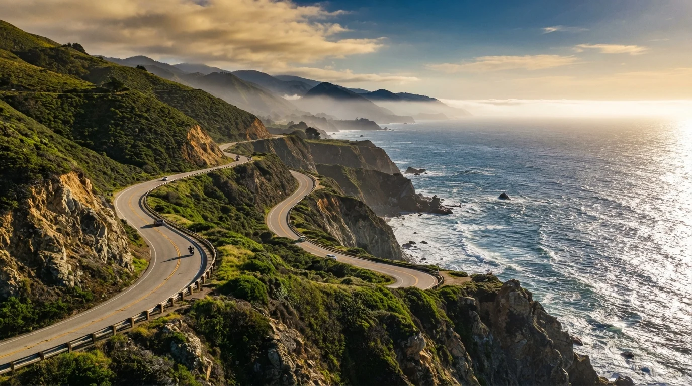
The roughly 90-mile stretch between San Simeon and Carmel is what most people picture when they imagine PCH. Bixby Creek Bridge (often photographed from the pullout to its north), McWay Falls dropping directly onto the beach at Julia Pfeiffer Burns State Park, and the sheer cliffs of the Nacimiento-Fergusson Road junction are all concentrated here.
What the photos don't show: this road closes. Landslides, storm damage, and erosion have historically shut portions for months at a time. Always verify current road conditions through Caltrans (the California Department of Transportation) before departing — this is non-negotiable. Cell service is limited throughout Big Sur; download offline maps in advance.
Gas up in Cambria heading north or Carmel heading south; stations in between are sparse and prices reflect the isolation. For those curious how PCH compares to another dramatic coastal and mountain circuit, the Pacific Northwest Loop offers a compelling counterpoint.
Northern Coast: Monterey to Leggett
North of Carmel, the Monterey Peninsula delivers Pebble Beach's 17-Mile Drive (a toll road worth noting in your budget) and the charming storefronts of Pacific Grove. The road continues through Santa Cruz — a lively surf and boardwalk city — before reaching Half Moon Bay and then the dramatic fog-prone cliffs of the Marin Headlands north of San Francisco.
Beyond the Golden Gate, SR-1 becomes genuinely remote. The Lost Coast and the Avenue of the Giants redwood corridor signal the route's final, quieter chapters. The highway officially ends at Leggett, where SR-1 merges into US-101. Most drivers consider this northern stretch meditative rather than spectacular — a slow exhale after the drama of Big Sur.